


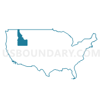
Southeast Idaho--Pocatello, Chubbuck Cities & Fort Hall Reservation PUMA, Idaho
About
Outline

Summary
| Unique Area Identifier | 192783 |
| Name | Southeast Idaho--Pocatello, Chubbuck Cities & Fort Hall Reservation PUMA |
| State | Idaho |
| Area (square miles) | 7,660.12 |
| Land Area (square miles) | 7,469.97 |
| Water Area (square miles) | 190.16 |
| % of Land Area | 97.52 |
| % of Water Area | 2.48 |
| Latitude of the Internal Point | 42.55025960 |
| Longtitude of the Internal Point | -112.09756940 |
Maps

Graphs
Select a template below for downloading or customizing gragh for Southeast Idaho--Pocatello, Chubbuck Cities & Fort Hall Reservation PUMA, Idaho


Neighbors
Neighoring Public Use Microdata Area (by Name) Neighboring Public Use Microdata Area on the Map
- Bingham (Outside Fort Hall AIR), Madison, Jefferson, Fremont & Teton Counties PUMA, ID
- Bonneville County--Idaho Falls City PUMA, ID
- Cache, Summit, Morgan & Rich Counties PUMA, UT
- Elmore, Jerome, Blaine, Minidoka, Gooding, Lincoln & Camas Counties PUMA, ID
- Sheridan, Park, Teton, Lincoln & Big Horn Counties PUMA, WY
- Tooele & Box Elder Counties PUMA, UT
- Twin Falls & Cassia Counties--Twin Falls City PUMA, ID
Top 10 Neighboring County (by Population) Neighboring County on the Map
- Cache County, UT (112,656)
- Bonneville County, ID (104,234)
- Bannock County, ID (82,839)
- Box Elder County, UT (49,975)
- Bingham County, ID (45,607)
- Cassia County, ID (22,952)
- Blaine County, ID (21,376)
- Lincoln County, WY (18,106)
- Franklin County, ID (12,786)
- Power County, ID (7,817)
Top 10 Neighboring County Subdivision (by Population) Neighboring County Subdivision on the Map
- Pocatello CCD, Bannock County, ID (71,772)
- Blackfoot CCD, Bingham County, ID (14,694)
- Afton CCD, Lincoln County, WY (12,578)
- Moreland CCD, Bingham County, ID (10,134)
- Preston CCD, Franklin County, ID (9,398)
- American Falls CCD, Power County, ID (6,166)
- Lewiston CCD, Cache County, UT (6,162)
- South Bannock CCD, Bannock County, ID (5,286)
- Malad City CCD, Oneida County, ID (3,931)
- Soda Springs CCD, Caribou County, ID (3,907)
Top 10 Neighboring Place (by Population) Neighboring Place on the Map
- Pocatello city, ID (54,255)
- Chubbuck city, ID (13,922)
- Blackfoot city, ID (11,899)
- Preston city, ID (5,204)
- American Falls city, ID (4,457)
- Fort Hall CDP, ID (3,201)
- Soda Springs city, ID (3,058)
- Montpelier city, ID (2,597)
- Malad City city, ID (2,095)
- Lewiston city, UT (1,766)
Top 10 Neighboring Unified School District (by Population) Neighboring Unified School District on the Map
- Pocatello School District 25, ID (76,013)
- Cache School District, UT (64,634)
- Box Elder School District, UT (49,975)
- Cassia County Joint School District 151, ID (22,454)
- Blackfoot School District 55, ID (21,668)
- Blaine County School District 61, ID (21,376)
- Lincoln County School District 2, WY (13,408)
- Preston Joint School District 201, ID (10,253)
- Snake River School District 52, ID (7,898)
- American Falls Joint School District 381, ID (7,200)
Top 10 Neighboring State Legislative District Lower Chamber (by Population) Neighboring State Legislative District Lower Chamber on the Map
- State House District 31, ID (45,173)
- State House District 29, ID (44,248)
- State House District 25, ID (43,165)
- State House District 28, ID (41,905)
- State House District 27, ID (38,757)
- State House District 30, ID (38,591)
- State House District 3, UT (38,268)
- State House District 2, UT (34,283)
- State House District 1, UT (34,122)
- State House District 4, UT (28,046)
Top 10 Neighboring State Legislative District Upper Chamber (by Population) Neighboring State Legislative District Upper Chamber on the Map
- State Senate District 17, UT (102,922)
- State Senate District 25, UT (89,262)
- State Senate District 31, ID (45,173)
- State Senate District 29, ID (44,248)
- State Senate District 25, ID (43,165)
- State Senate District 28, ID (41,905)
- State Senate District 27, ID (38,757)
- State Senate District 30, ID (38,591)
- State Senate District 16, WY (23,184)
- State Senate District 14, WY (19,890)
Top 10 Neighboring 111th Congressional District (by Population) Neighboring 111th Congressional District on the Map
- Congressional District 1, UT (906,660)
- Congressional District 2, ID (725,652)
- Congressional District (at Large), WY (563,626)
Top 10 Neighboring Census Tract (by Population) Neighboring Census Tract on the Map
- Census Tract 3, Bannock County, ID (9,052)
- Census Tract 9505, Bingham County, ID (7,811)
- Census Tract 11.01, Bannock County, ID (7,440)
- Census Tract 9504, Bingham County, ID (6,883)
- Census Tract 9780, Lincoln County, WY (6,801)
- Census Tract 9702, Franklin County, ID (6,718)
- Census Tract 9602, Power County, ID (6,166)
- Census Tract 9701, Franklin County, ID (6,068)
- Census Tract 9503, Bingham County, ID (5,914)
- Census Tract 9781, Lincoln County, WY (5,777)
Top 10 Neighboring 5-Digit ZIP Code Tabulation Area (by Population) Neighboring 5-Digit ZIP Code Tabulation Area on the Map
- 84321, UT (44,074)
- 83201, ID (37,199)
- 83221, ID (27,021)
- 83202, ID (21,608)
- 83204, ID (18,026)
- 83350, ID (12,268)
- 84337, UT (11,393)
- 83263, ID (9,258)
- 83211, ID (6,374)
- 83110, WY (4,307)